


Our totally revised Northern New Jersey Highlands Trails Map (formerly titled North Jersey Trails) is a four-map set featuring more than 360 miles of marked trails and more than 40 parks and preserves in the northern Highlands region of New Jersey. The maps are printed in vibrant color on waterproof and tear-resistant Tyvek, and are a must-have for exploring the wealth of outstanding trails in northern New Jersey.
Rebuilt from the ground up, this map is basically a brand new map and the most significant update to these maps in nearly 15 years, with an expansion to a four-map set instead of just two maps, a major increase in scale, addition of trail mileage numbers, a new map showing more of the Appalachian Trail, and many more improvements.
Among the major improvements to this 2021 revision are:
- New title (instead of former North Jersey Trails) to both better highlight the actual coverage area of the northern Highlands region in New Jersey, and highlight that these represent a significant change from the previous edition.
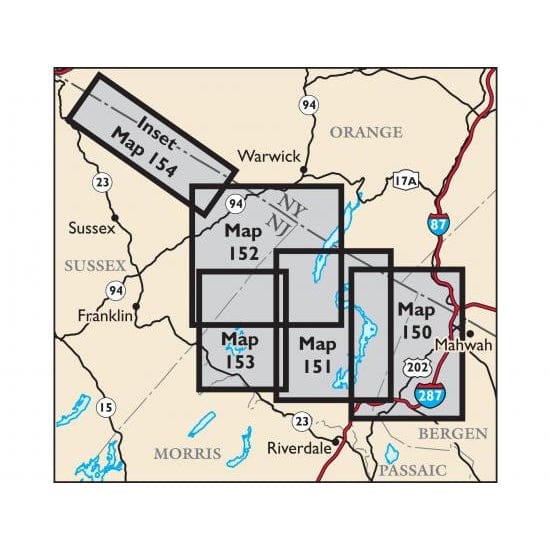
- Expansion to a 4-map set from a 2-map set.
- Major 33% increase in scale to improve the clarity of the trail networks.
- Detailed junction-to-junction trail mileage numbers directly on the map front.
- New map showing the Appalachian Trail between High Point State Park and Pochuck Boardwalk, which includes a portion of the Wallkill River National Wildlife Refuge.
- Completely redrawn trails using the latest data, with more than 360 miles of marked trails (an increase of more than 80 miles compared to the previous edition).
- Upwards of 75 miles of trail updates in 6 state parks/state forests that had significant trail additions/changes completed recently by Trail Conference volunteers.
- New detailed elevation contour lines, and a completely revised basemap of roads, lakes, streams, park boundaries, and other features built from the ground up.
- Orientation changed to put North straight up, consistent with our adjacent maps of Sterling Forest, Harriman-Bear Mountain, and Jersey Highlands (new edition in-progress, to be retitled Morris County Highlands).
- Several additional parks and trails not included on the previous edition, including trails at Highlands Preserve, Nancy Conger West Brook Preserve, Old Mill Woodlands, and Ramapo Mountain Preserve.
- Several birding hotspots added with assistance from the Saw Mill River Audubon to highlight areas of special interest for birding.
- More viewpoint stars, parking areas, and interesting points of interest.
This new Northern New Jersey Highlands Trails Map is the most comprehensive and accurate map yet of this vast area of trails and parks in the northern Highlands of New Jersey.
Map features include:
- More than 360 miles of marked trails in northern New Jersey (Bergen, Passaic and Sussex Counties) and nearby areas of New York (Orange and Rockland Counties)
- 40 parks and preserves, including:
- Abram S. Hewitt State Forest
- Appalachian Trail Corridor
- Campgaw Mountain County Reservation
- Long Pond Ironworks State Park
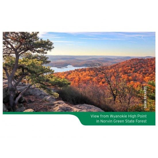
- Norvin Green State Forest
- Pequannock Watershed
- Ramapo Mountain State Forest
- Ramapo Valley County Reservation
- Ringwood State Park
- Wallkill River National Wildlife Refuge
- Wawayanda State Park
- More than 30 miles of the Appalachian Trail
- Nearly 40 miles of the Highlands Trail
- Detailed junction-to-junction trail mileage numbers
- 20-foot elevation contours
- 1:30,000 scale
- Convenient map sizes to carry and use on the trail
- Complete trail index with blaze details and total trail mileage on map back
- Enlarged inset maps of many popular areas, including Ramapo Valley County Reservation, Campgaw Mountain County Reservation, Wyanokie High Point and Roomy Mine in Norvin Green State Forest, and the Terrace Pond area of Wawayanda State Park
- Unmaintained trails and woods roads
- Parkland boundaries, viewpoints, campsites, shelters, waterfalls, mines, and other points of interest
- Parking areas
- Public transportation
- Park contact information, history, and regulations
- UTM coordinate grid